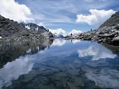
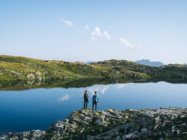
From the municipal house in Claro (296 m), in Val Riviera, the path leads to the Laghetto di Canée. The first stop is Censo (771 m), which can also be reached by car. The trail continues via Moncrino nord (808 m), via Bens (1174 m) to Alpe di Peurett (1745 m) and finally to Alpe Canée (1995 m) with the small lake above (2198 m).
The descent can be made along the same route or, having reached Peurett, by following an alternative one. Continuing initially along the 'road' opened up by Polish soldiers who had fled to Switzerland during World War II, one can head towards the Garerescio (1783 m), Forcarid (1713 m), Domàs (1666 m) and Maruso (1135 m) alps. From here you can head towards Claro via the Santa Maria monastery; or you can descend to Monte Nuovo and Tea, and return to Censo. The walk takes 5 hours and 45 minutes from Claro (approx. 4 from Censo); the hike requires good physical preparation due to the considerable altitude difference (1902, respectively 1427 m).
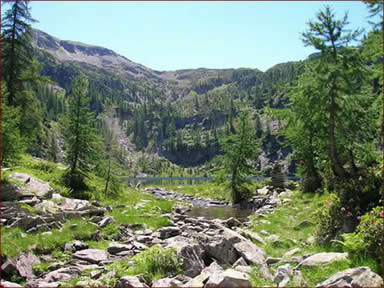
Another possibility is to go from the small lake, climbing towards the ridge that looks in the direction of the Calanca Valley, to the Alpe di Motto and then descend to Domàs. As far as overnight accommodation is concerned, there are three huts available: the Peurett (1745 m), Garerescio (1783 m), and Provei (1322 m).
From LAGHETTI ALPINI TICINESI (no. 27) published by Banca del Gottardo.
Features
- NATURE Alpine lakes